
The Thalangama Area
FLOOD PREVENTION
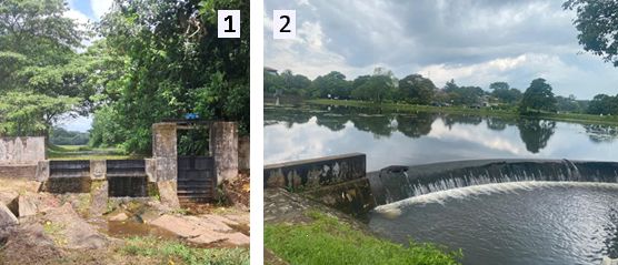
To increase its flood retention capacity, a larger dredging project (Madiwela East Diversion Scheme - Part I) was carried out at the Thalangama lake in 2017. The dredging reclaimed a significant lake area (see aerial photos time line) which was overgrown largely with Wel Atha trees (Annona glabra L.) while preserving some tree islands to maintain local biodiversity and night resting places for birds. See this link for the CEA EIA which has many details about the area and project.

The dredging was needed from an irrigation perspective because siltation had the original capacity of the Thalangama tank of 50-60 Ac.ft. (61,000-74,000m3) decreased to an estimated 32 Ac.ft. (39,000 m3) causing a water deficit for the paddy farmers. The immediate impact of the dredging was, however, the release of plant nutrients from the moved and removed sediments and trees into the water, resulting in a rapid spread of nutrient-loving water hyacinths on the central part of the lake which the Wetland Watch had to tackle.
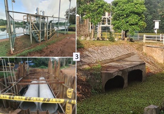
After the dredging ended in 2017, the banks of the smaller Averihena tank were reinforced. One reason for this was another newly constructed flood gate connecting via two larger tubes the Thalangama lake with the canal towards the Averihena lake (photos 3). These tubes which are crossing the road next to the circular spillway can be opened remotely via a so called ‘digital twin’ (a virtual copy of the water flow system on a computer). Depending on rain forecasts, it is possible to release through these tubes on short notice significant amounts of water from the Thalangama lake allowing the lake to absorb more water under expected extreme rainfall to prevent potential flooding. Since 2019, the gate was however only opened [manually] from time to time for maintenance purposes or demonstrations, even under Cyclone Ditwah.
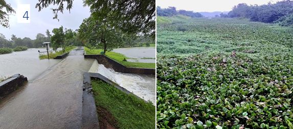
One challenge is that under severe rainfall, the water might not drain towards the Kelani river which can be so loaded (like it happened under Ditwah) that the river water is pushed back into its tributaries to flow upstream towards the Averihena lake from where it passed the ‘shoe bridge’ (causeway, photo 4) to flood the paddy fields, direction Parliament. This did not happen in Nov 2025 as the causeway top level was increased under the Madiwela project, in contrast to 2010.
The flow towards the Kelani river today (2026) is also challenged by a thick carpet of Water hyacinths between the Averihena lake and beyond the Amaragoda road bridge, slowing water movements considerably down (photo 5).